
CLEVELAND — Rain will be steady and likely through your evening so plan on extra drive time and wet roads. It's breezy too. The steady rain will become scattered later tonight as we fall into the 40s. Overcast skies otherwise.
Tomorrow will be a chilly, damp day behind the front. We will essentially hold in the 40s with leftover shower chances.
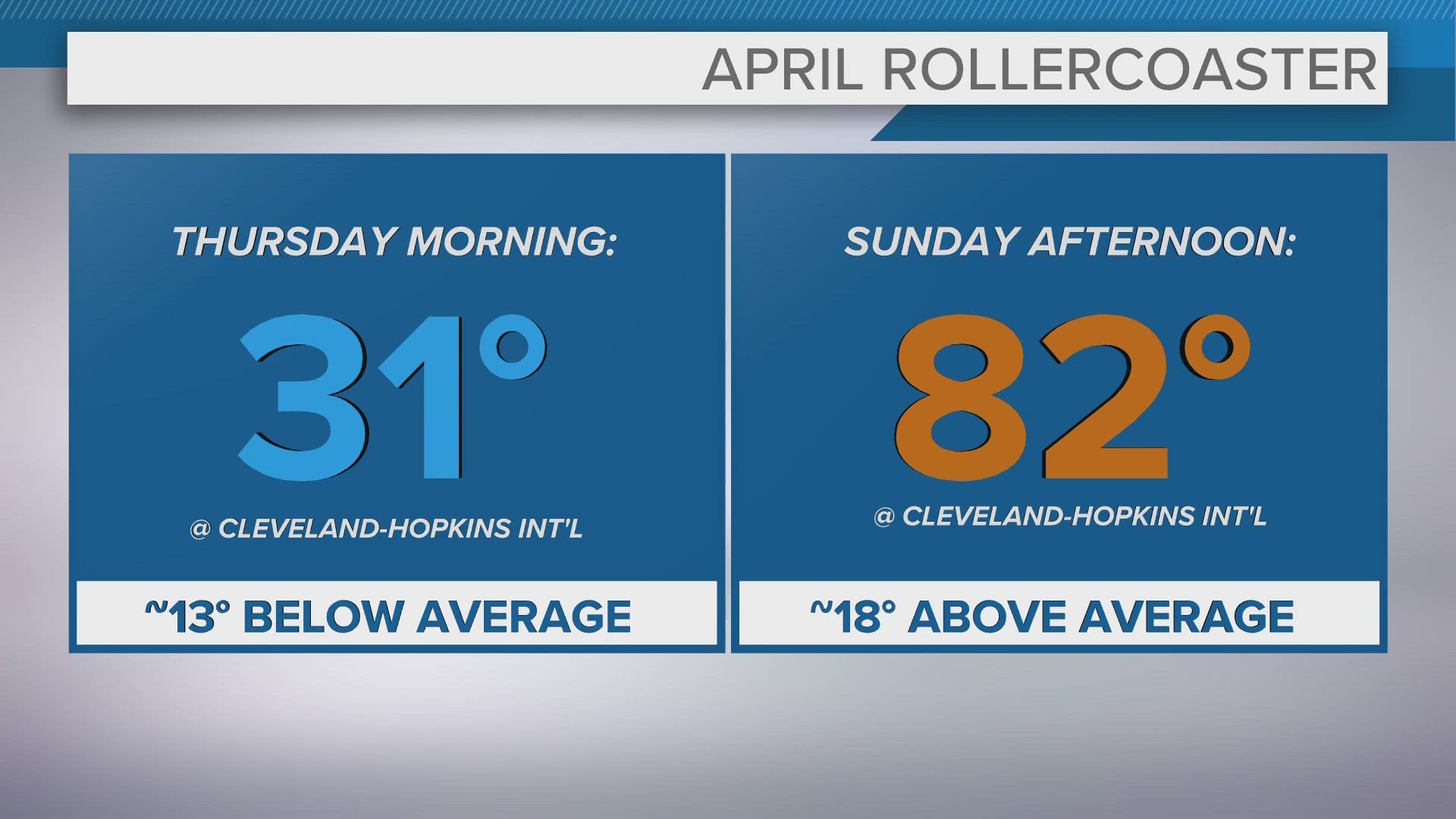
We will start to clear late in the day and by tomorrow night under clear to partly cloudy skies, temperatures will dip into the 30s. Frost likely... again. And a FREEZE WATCH is already in place from late Wednesday night through Thursday morning for NE Ohio. Sub-freezing temperatures as low as 28 degrees will be possible.
We are sun filled Thursday and will rebound into the 50s, still trending cool for this time of year. It won't last long though -- we'll quickly turn the temps around with a surge toward 80 degrees this weekend! Hang in there!
3 DAY FORECAST
TONIGHT: Rain likely early, more scattered later. Breezy. 40s.
WEDNESDAY: Early showers otherwise isolated chances later with lingering clouds. Cold with steady temps in the 40s.
THURSDAY: Cold start! Then sunshine with high clouds. Still cool with highs in the mid 50s.
Here are some quick weather resources you can use:
---------------------------------------------------------------------------------------------------
Get more weather from the 3News Weather team of Betsy Kling (@betsykling), Matt Wintz (@WintzWeather), Anthony Copeland (@WeatherManAC) and Hollie Strano (@holliesmiles)
►MORE WEATHER | Get the latest weather headlines, video, photos & more
►ENVIRONMENT NEWS | Find out more about the world around us
►EARTH & SPACE NEWS | Learn more about our planet and outer space
►WEATHER FEATURES | Read our weather guides, storm reports & more
MORE WEATHER-RELATED HEADLINES: