
CLEVELAND — Like it or not, winter weather is here. We're tracking heavy snow throughout Northeast Ohio for the next few days.
The weather conditions will transition from a rain mix into snow as temperatures continue to drop into the night, said Chief Meteorologist Betsy Kling Monday evening.
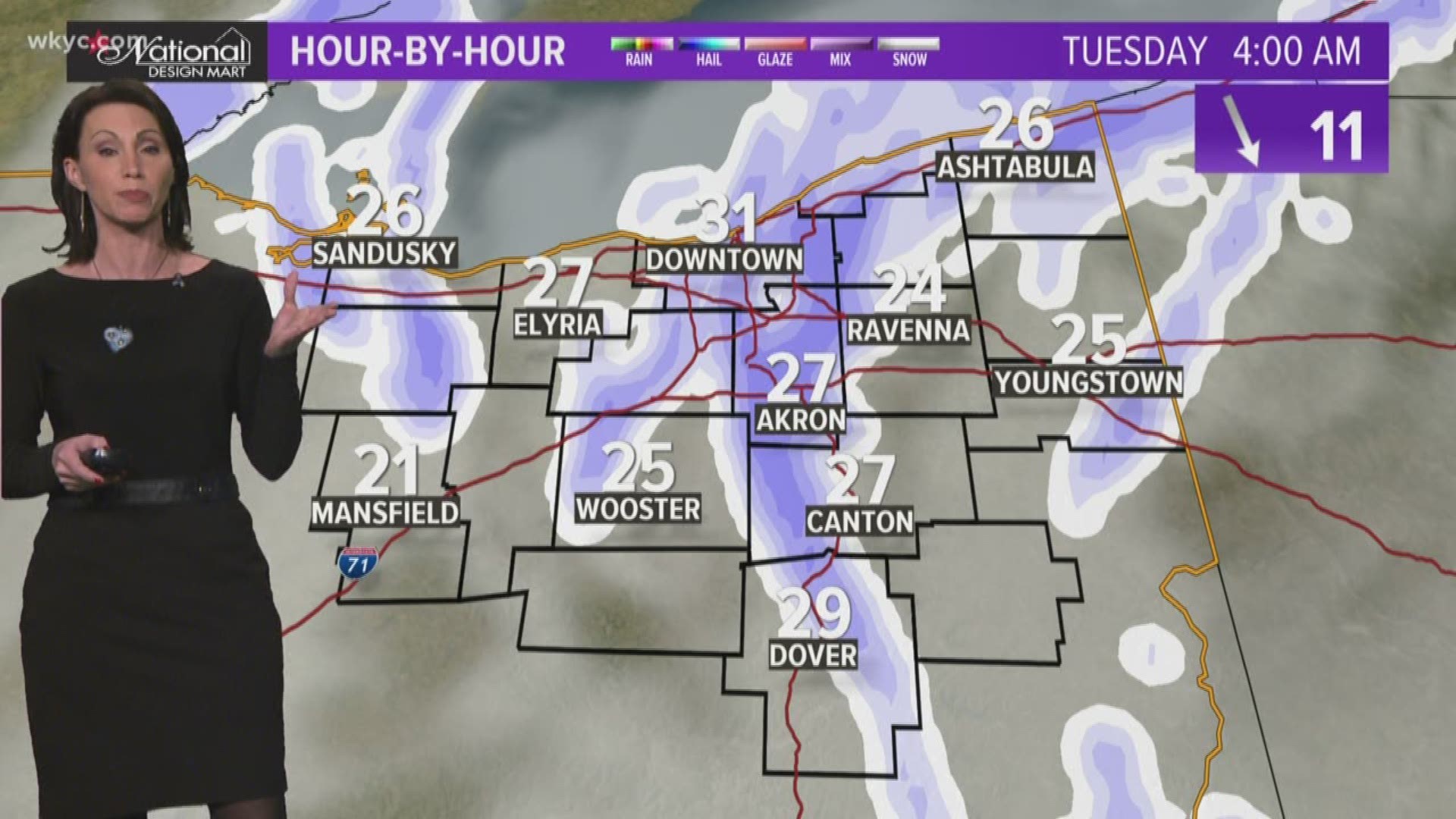
Kling checked in on YouTube and Facebook just before 10 p.m. with an outlook on the evening's conditions, the roadways and what you can expect during your morning commute.
"Plan on a lengthy commute," says Kling as she shows areas of Northeast Ohio that have already been blanketed with snow fall.
"Steady as she goes, take it easy, take your time," Betsy advises travelers ahead of the morning rush.
Meteorologists Matt Wintz and Jason Frazer gave us a live weather update just after 5:00 p.m. Check it out below:
3News Meteorologist Jason Frazer provided the following update at 1 p.m. with what to expect:
He'll provide another live update at 4 p.m. ahead of the evening commute.
►LIVE RADAR | Track the snow
The winter weather will begin Monday afternoon with a region-wide system snow. Once that moves out, lake effect snow will begin overnight and continue through Tuesday and into Wednesday.
“You should just go ahead and plan for a very challenging commute Tuesday morning,” Strano said.
For that reason, she's predicting school closings and delays for Tuesday morning.
►iALERT CLOSINGS | See the list
►SIGN UP | Free school closing text alerts
►EXTENDED FORECAST | 7-day outlook
"Our iAlerts are going to more than likely be pretty busy tomorrow," Strano said Monday morning. "I’m going to go out on a limb and say there will be closings and delays for your Tuesday.”
When the winter storm wraps up by Wednesday, Strano said some areas could see 8+ inches of snow -- or even more than that -- depending on where lake effect snow bands persist.
NOTE: You can put our radar in your pocket by downloading the free WKYC weather app for Android HERE and for Apple HERE.
The National Weather Service in Cleveland has issued a series of Winter Storm Warnings and Winter Weather Advisories throughout Northeast Ohio, which we have broken down below.
WINTER STORM WARNING: In effect from 4 p.m. Monday until 10 a.m. Wednesday.
- Ashtabula
- Cuyahoga
- Geauga
- Lake
WINTER WEATHER ADVISORY: In effect from 4 p.m. Monday until 7 p.m. Tuesday.
- Lorain
- Medina
- Portage
- Summit
- Trumbull
WINTER WEATHER ADVISORY: In effect from 4 p.m. Monday until 7 a.m. Tuesday.
- Ashland
- Richland
- Wayne
WINTER WEATHER ADVISORY: In effect from 1 p.m. Monday until 7 a.m. Tuesday.
- Erie
- Huron
- Ottawa
- Sandusky
- Seneca
►CURRENT WEATHER ALERTS | See the list